Welcome!
ChicagoinMaps.com is simply a website to gather together links to various historic maps of Chicago. The
Historic maps and
Thematic maps pages will link directly to specific maps. Additional collections, including some that don't allow direct linking, can be found on the
Sources and links page.
Chicago map stories is a look at some 50 historic Chicago maps and the interesting stories they tell. ChicagoinMaps.com is a labor of love by
Dennis McClendon at
Chicago CartoGraphics.
HISTORIC MAPS:
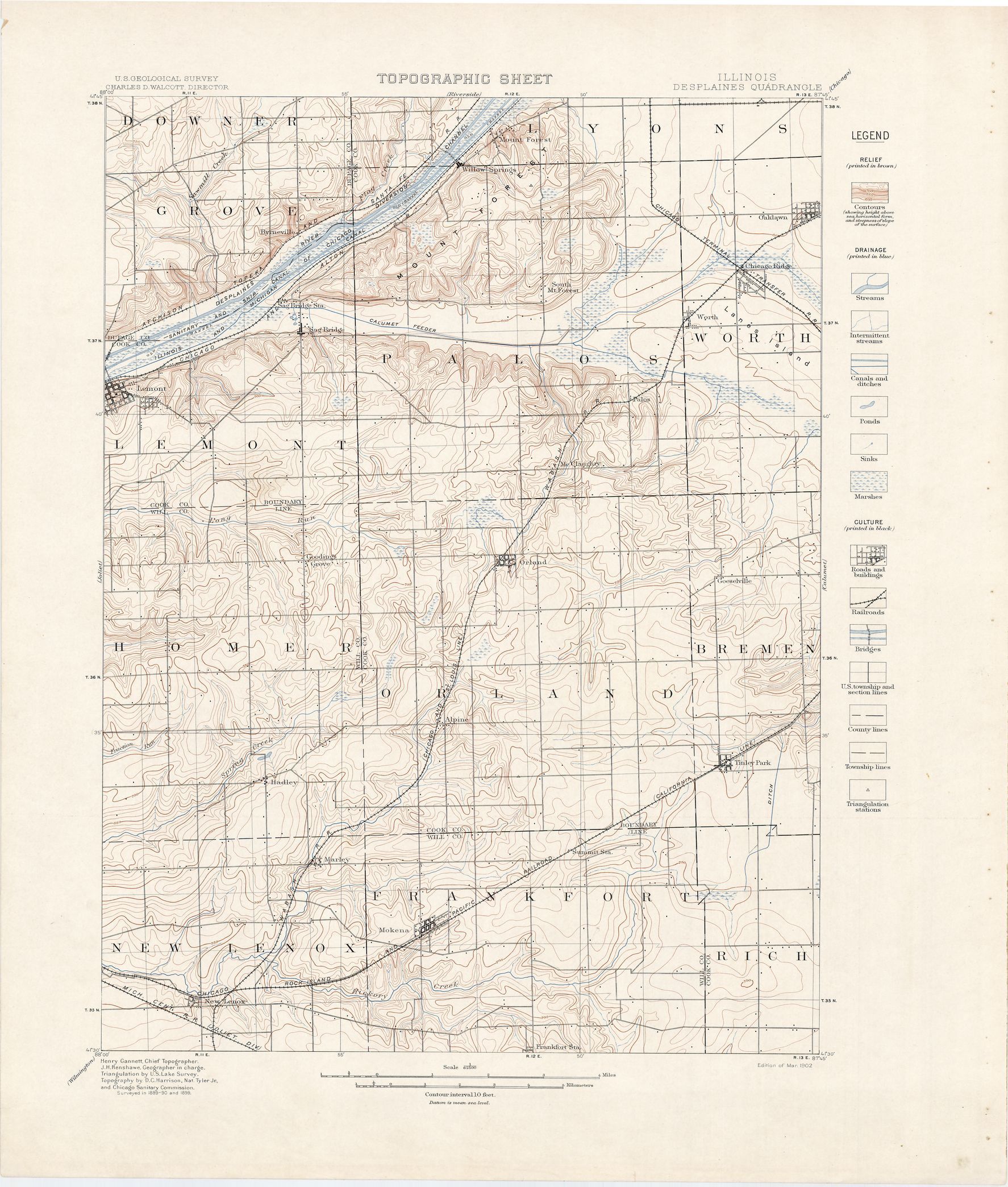
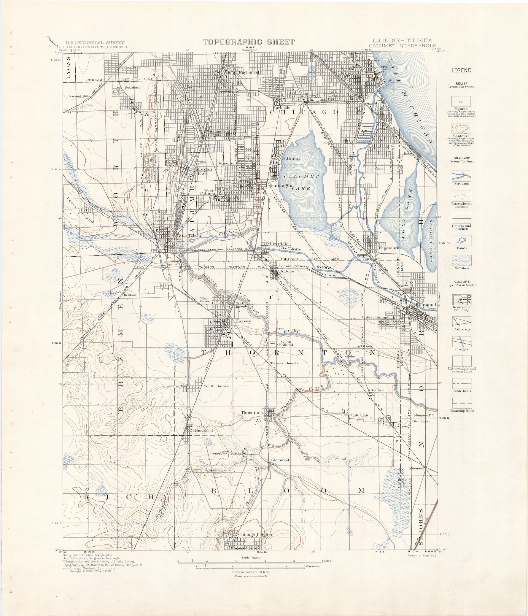
These are direct links to historic maps online. For entire collections, see also Sources and links.
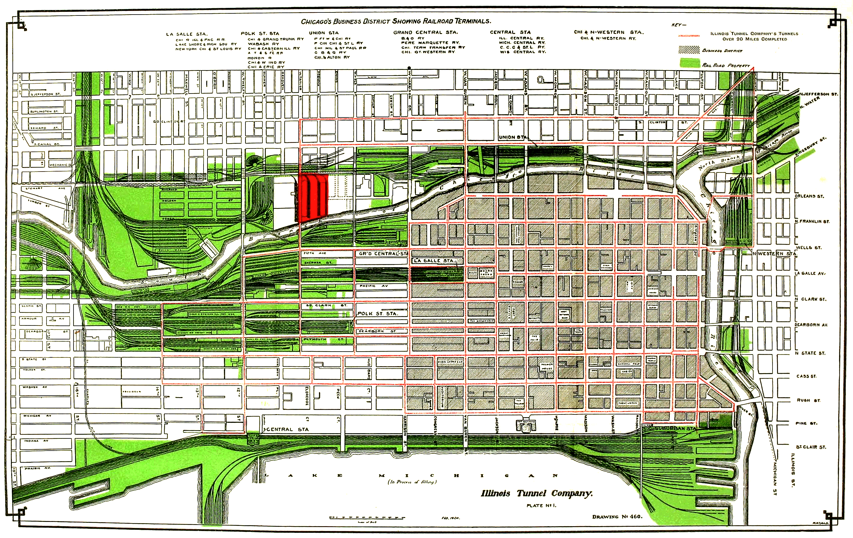
 | 1902 | Rand McNally map of Chicago railroads |
 | 1906 | Bibliographisches Institut in Leipzig map of Chicago |
 | 1914 | Rand McNally map of Chicago & vicinity
(railroad district) |
 | 1921 | Rand McNally map of Chicago railroads |
 | 1926 | Distribution of licensed drivers |
THEMED MAPS:
Geological maps of Chicago
 | Chicago Loop quadrangle
showing landfill in light green |
 | Lake Calumet quadrangle
showing lake before 1950s filling and port construction |
Complete portfolio of Chicago Area Geologic Maps
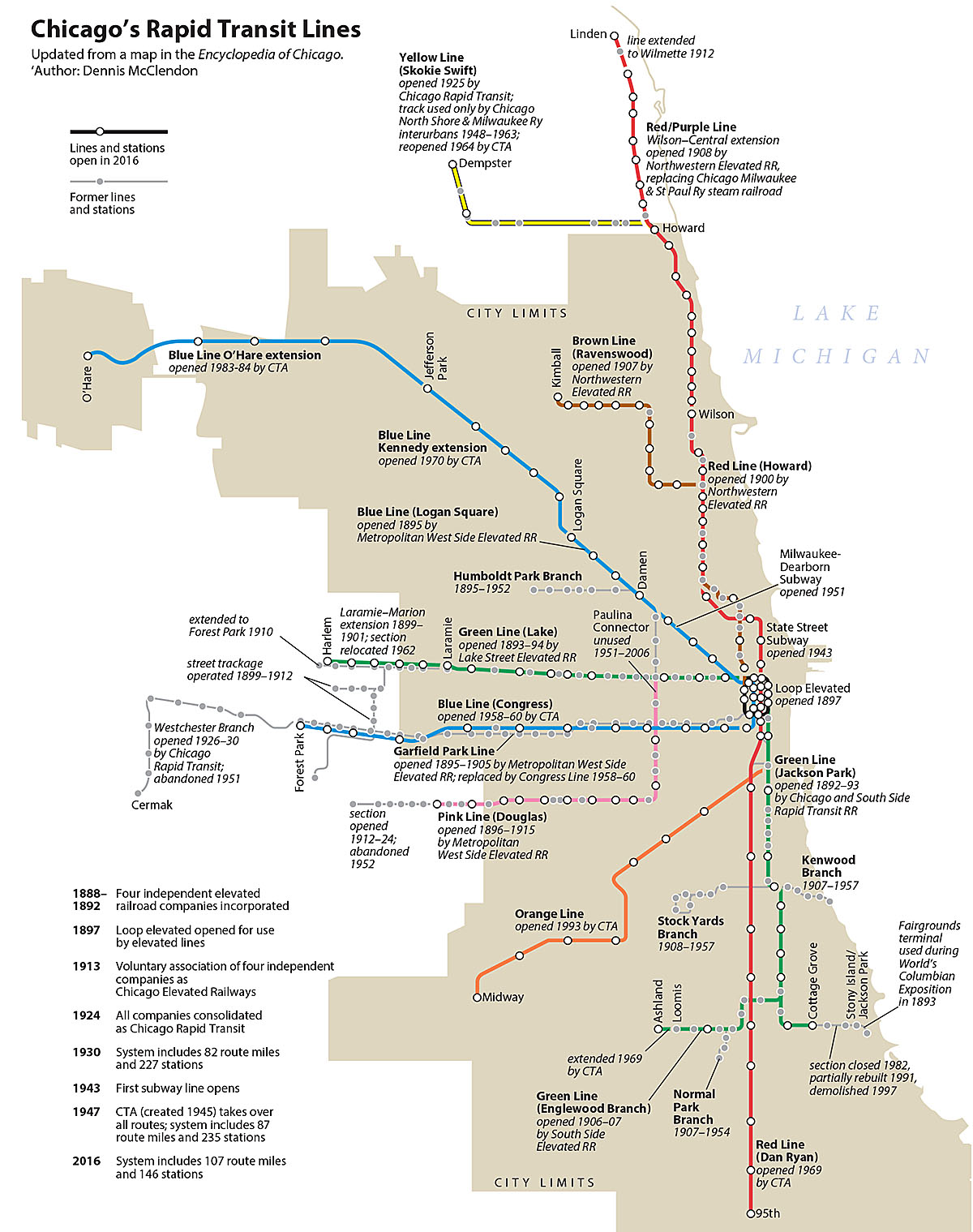
Chicago railroad maps
 | Open Railway Map
Open Street Map, emphasizing railroads and rail transit |
Chicago transit map collection online at Illinois Railway Museum
Chicago transit maps from Chicago-L.org:
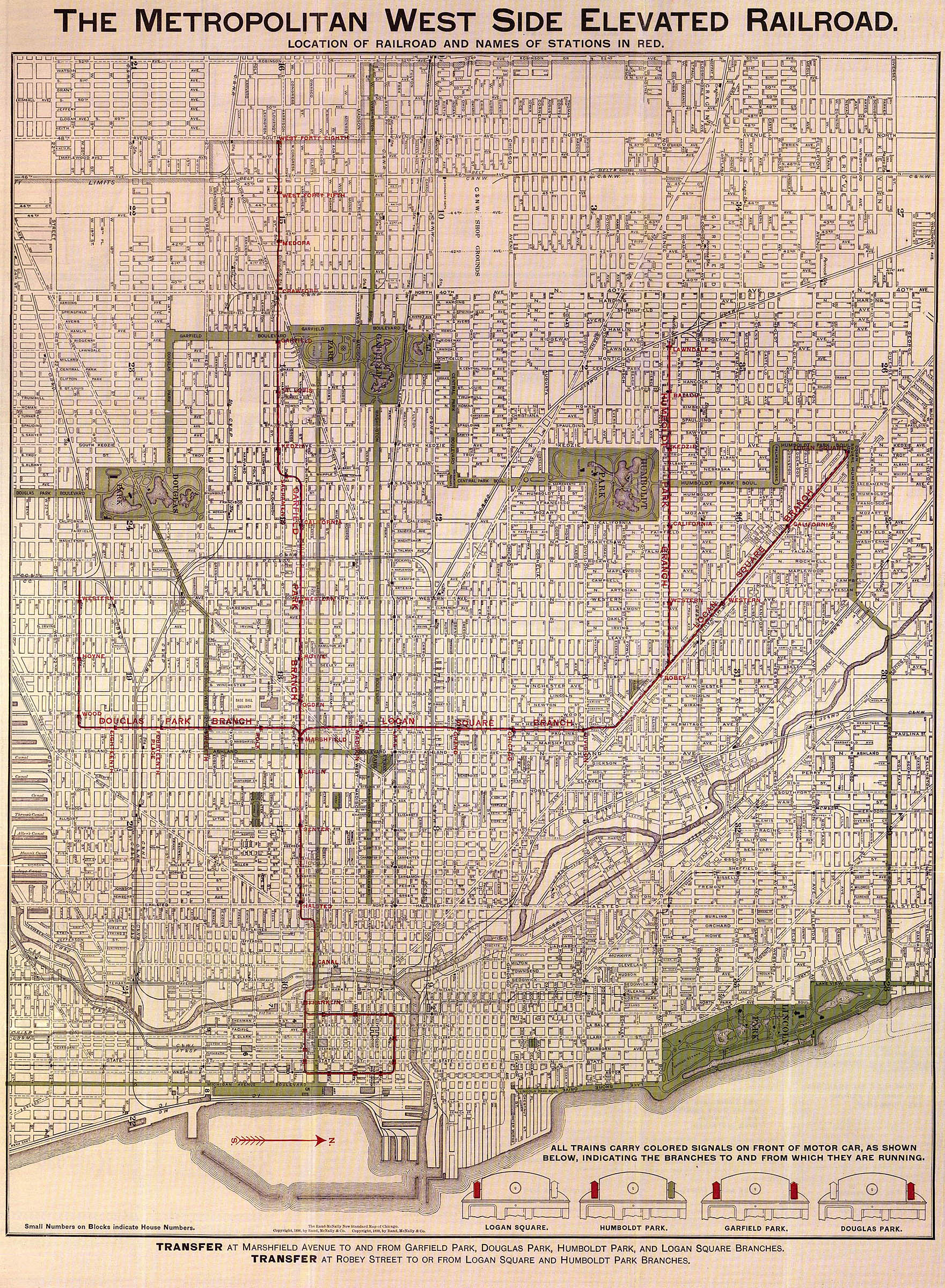
 | 1898 | Metropolitan West Side Elevated Railroad
shown on a complete street map |
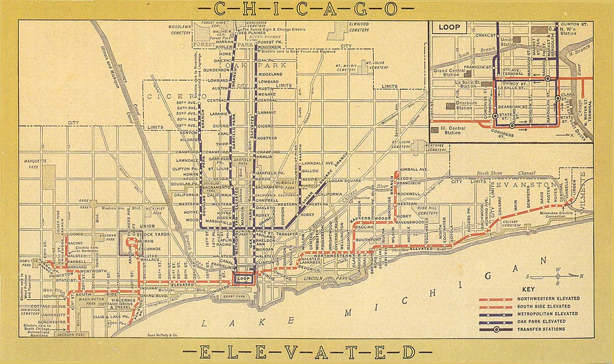
 | 1913 | Chicago Elevated Railways system map
|
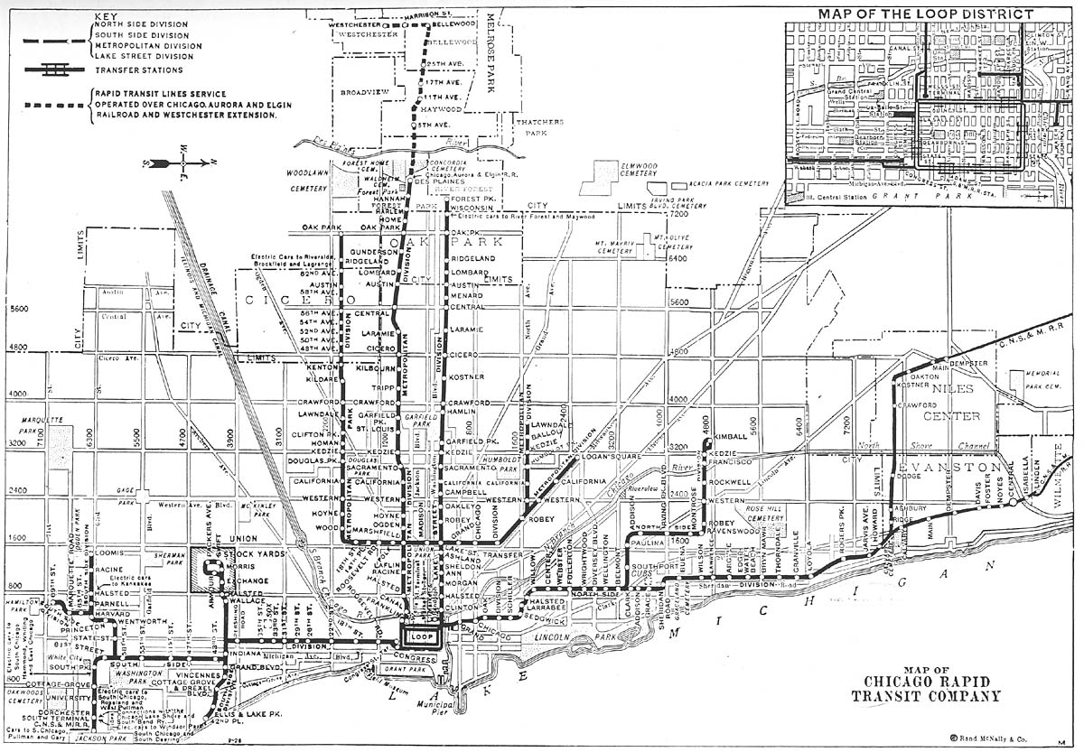
 | 1926 | Chicago Rapid Transit system map
|
 | 1933 | Chicago Rapid Transit system map
|
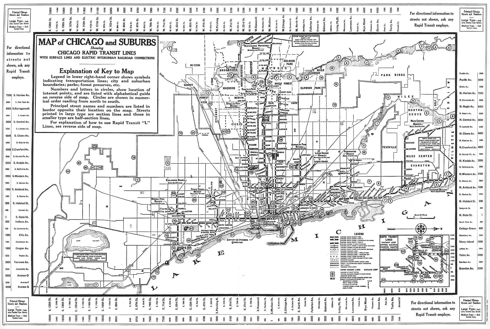
 | 1946 | Chicago Rapid Transit system map
|
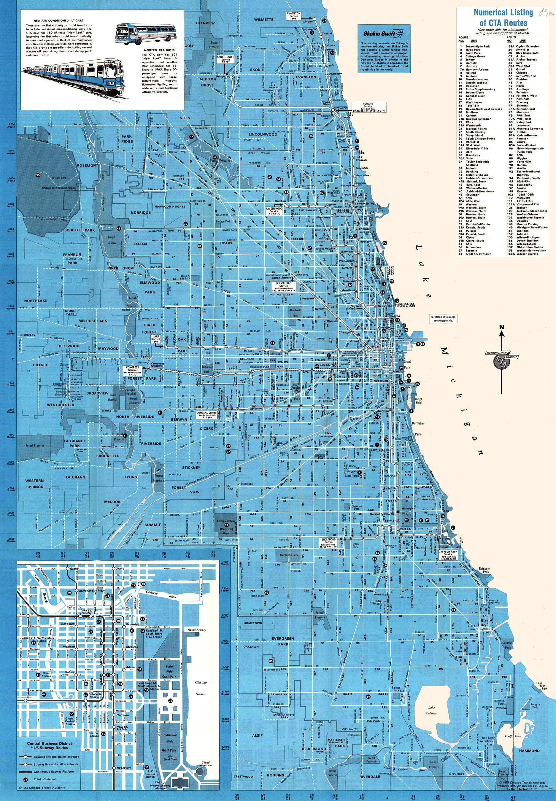
 | 1965 | Chicago Transit Authority system map
|
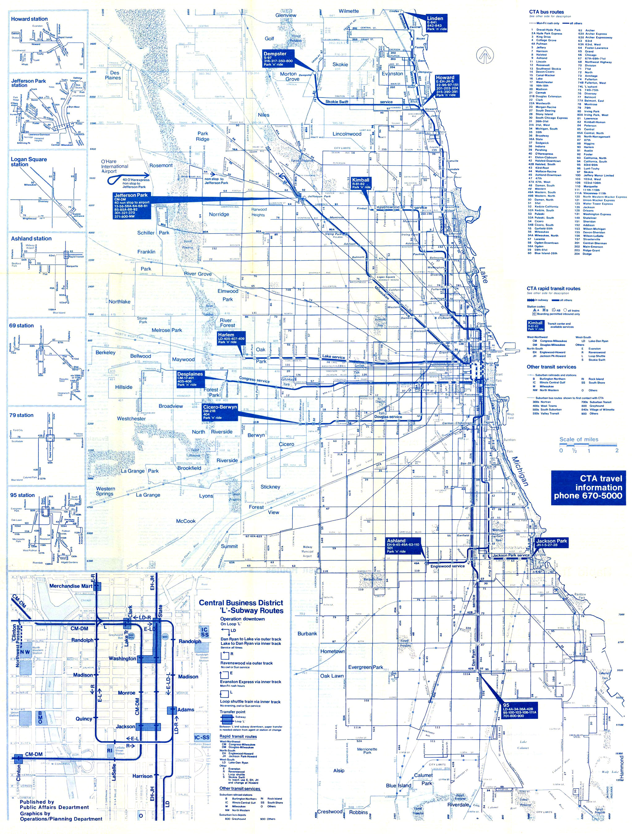
 | 1975 | Chicago Transit Authority system map
|
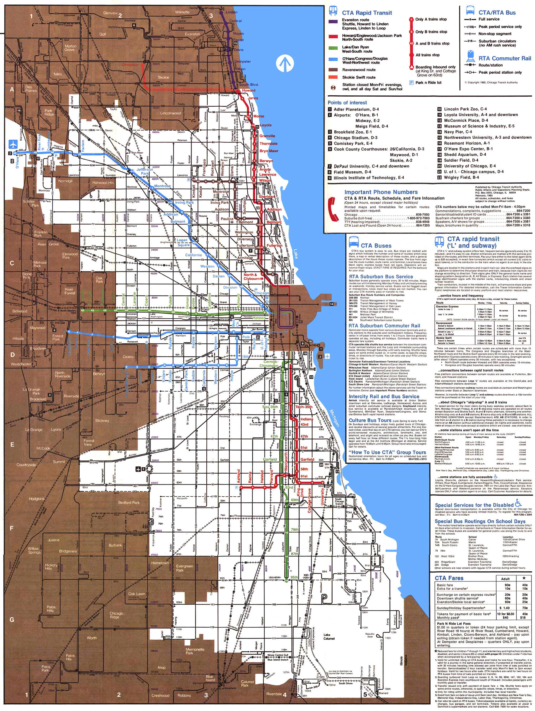
 | 1985 | Chicago Transit Authority system map
|
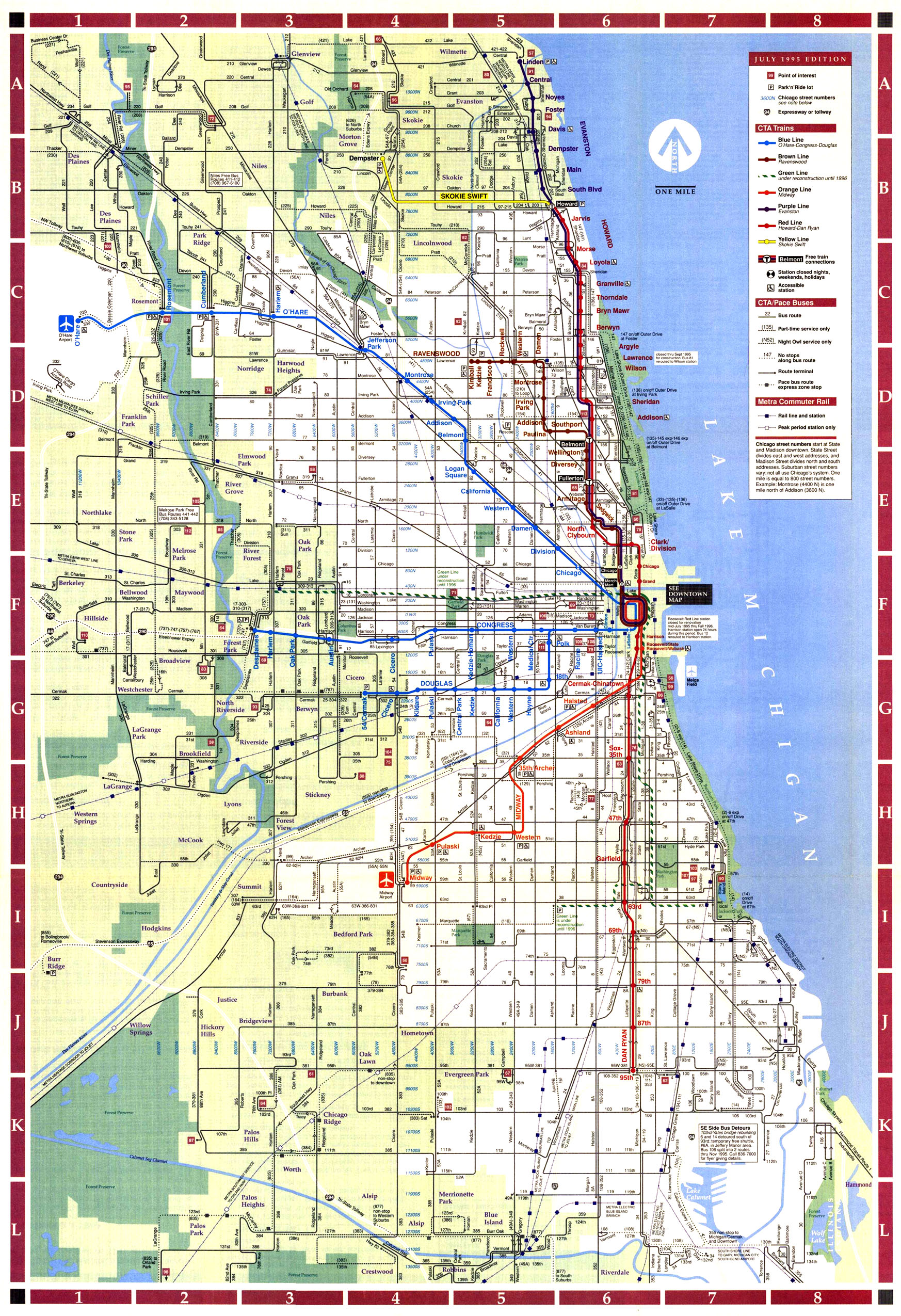
 | 1995 | Chicago Transit Authority system map
|


No comments:
Post a Comment